

Aerial Imaging & Mapping
See the whole site. Understand the terrain.
Aerial photography, 3D models, and GIS maps for developers, engineers, property owners, and project teams. We capture the data around the questions you need to answer.
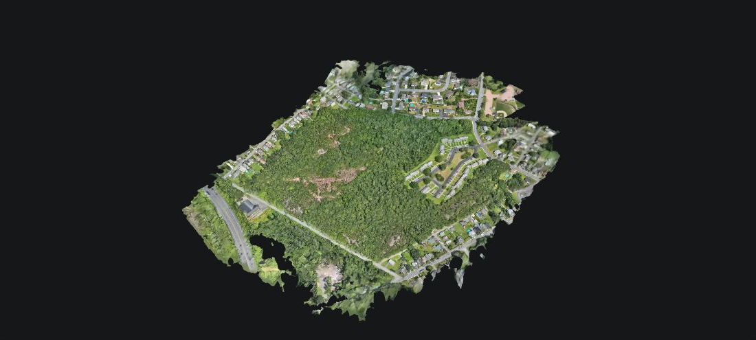
Explore a 3D Model
A small example of what our drones can do, built from stitched and processed DJI Matrice 4E photographs. We also create custom models of land, structures, and homes.
Open the 3D Viewer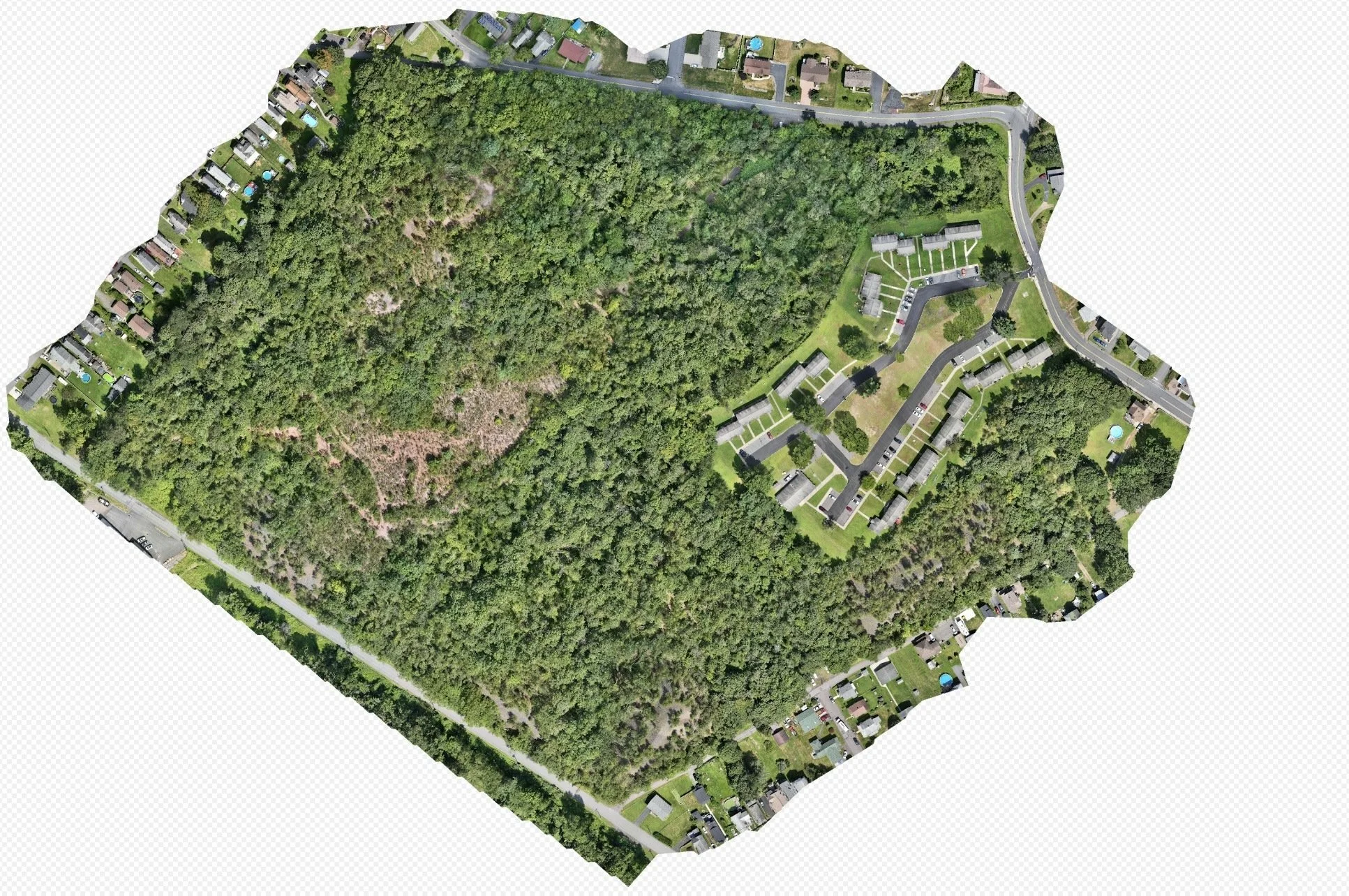
01 | Orthomosaic Site Overview A stitched aerial view brings roads, buildings, vegetation, and site access into one detailed picture.
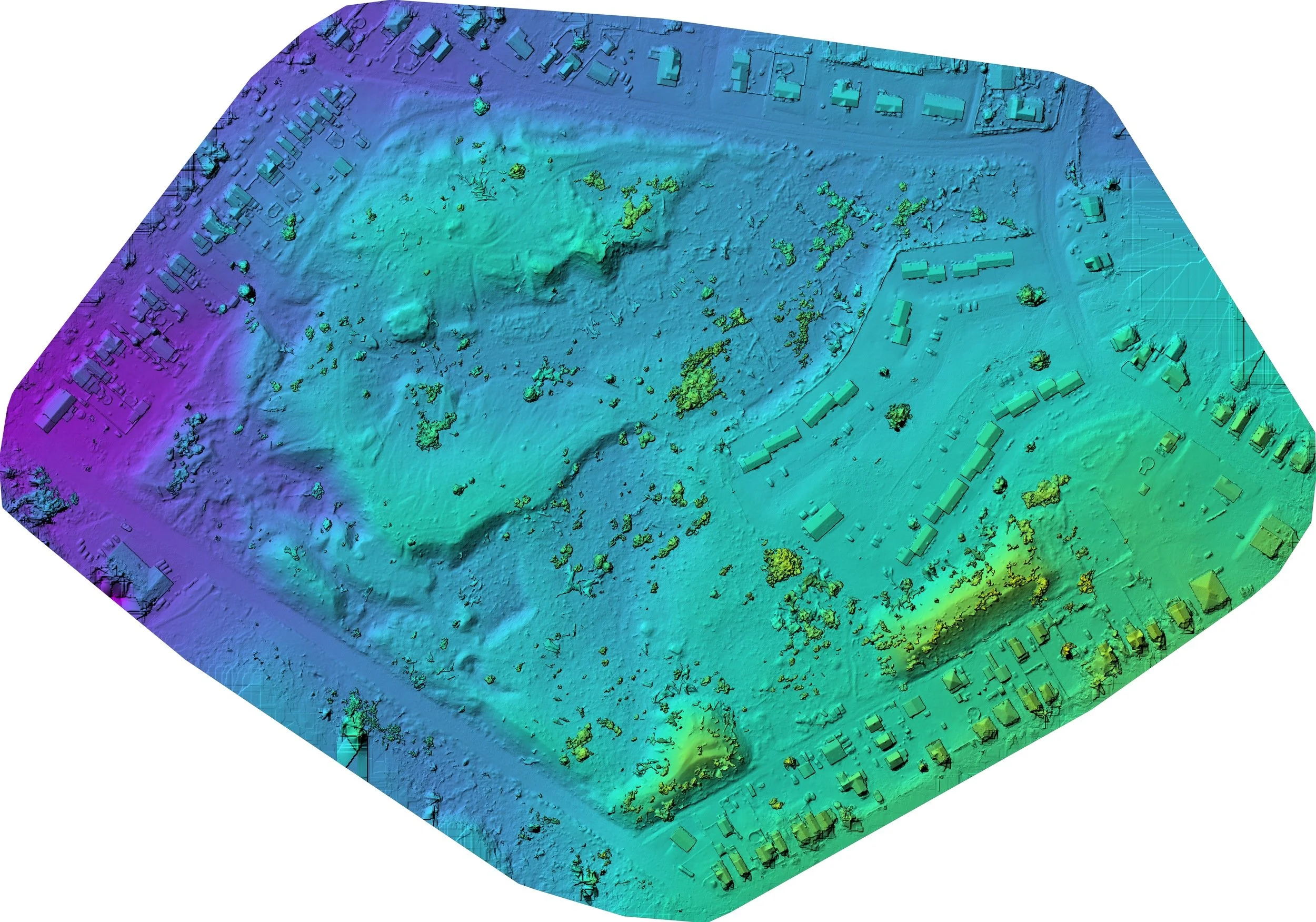
02 | Digital Surface Model A colorized surface model shows the relative elevation of visible terrain, buildings, and vegetation.
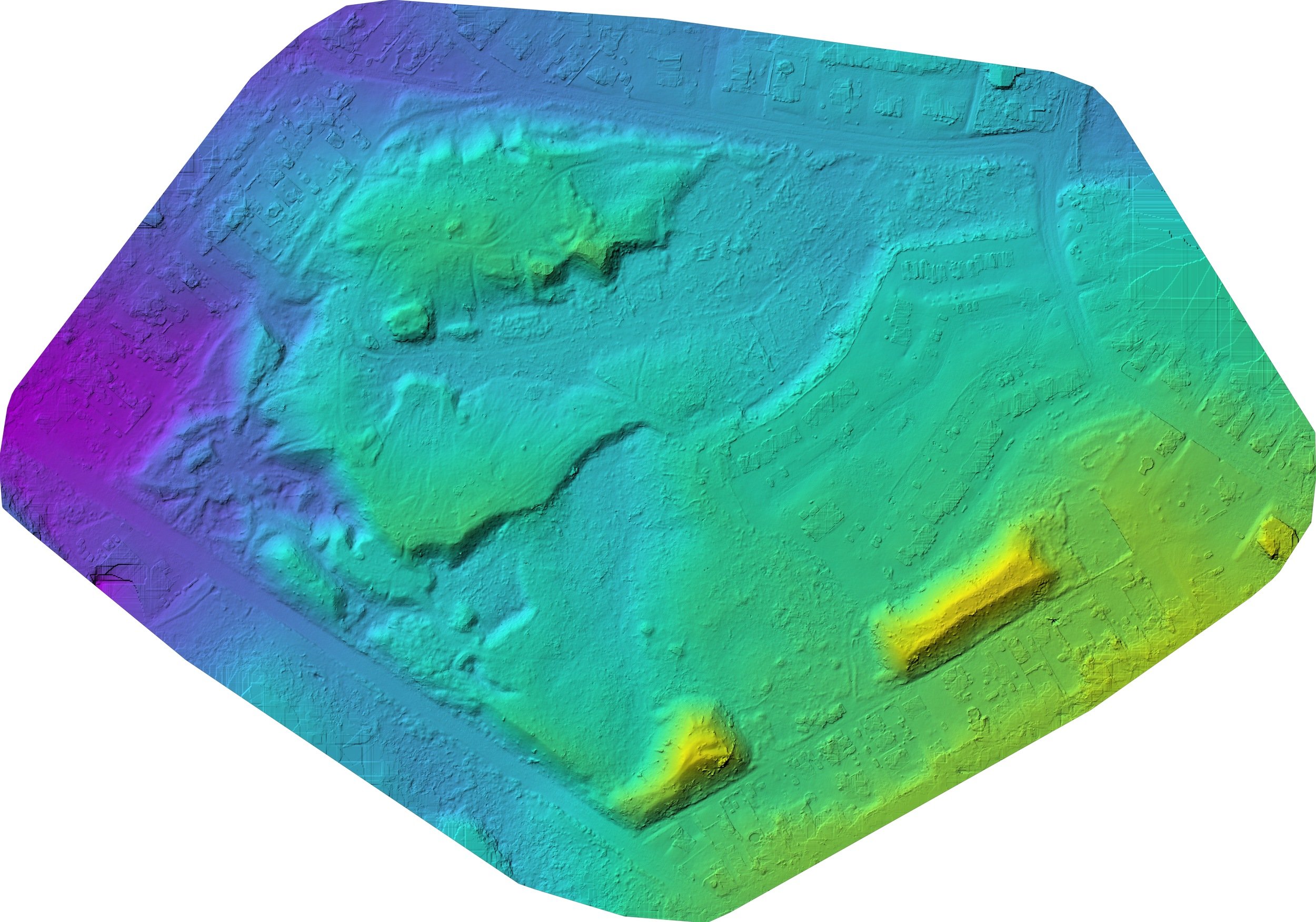
03 | Digital Terrain Model Classified ground data provides an estimated terrain surface. Vegetation cover and processing artifacts can limit interpretation.
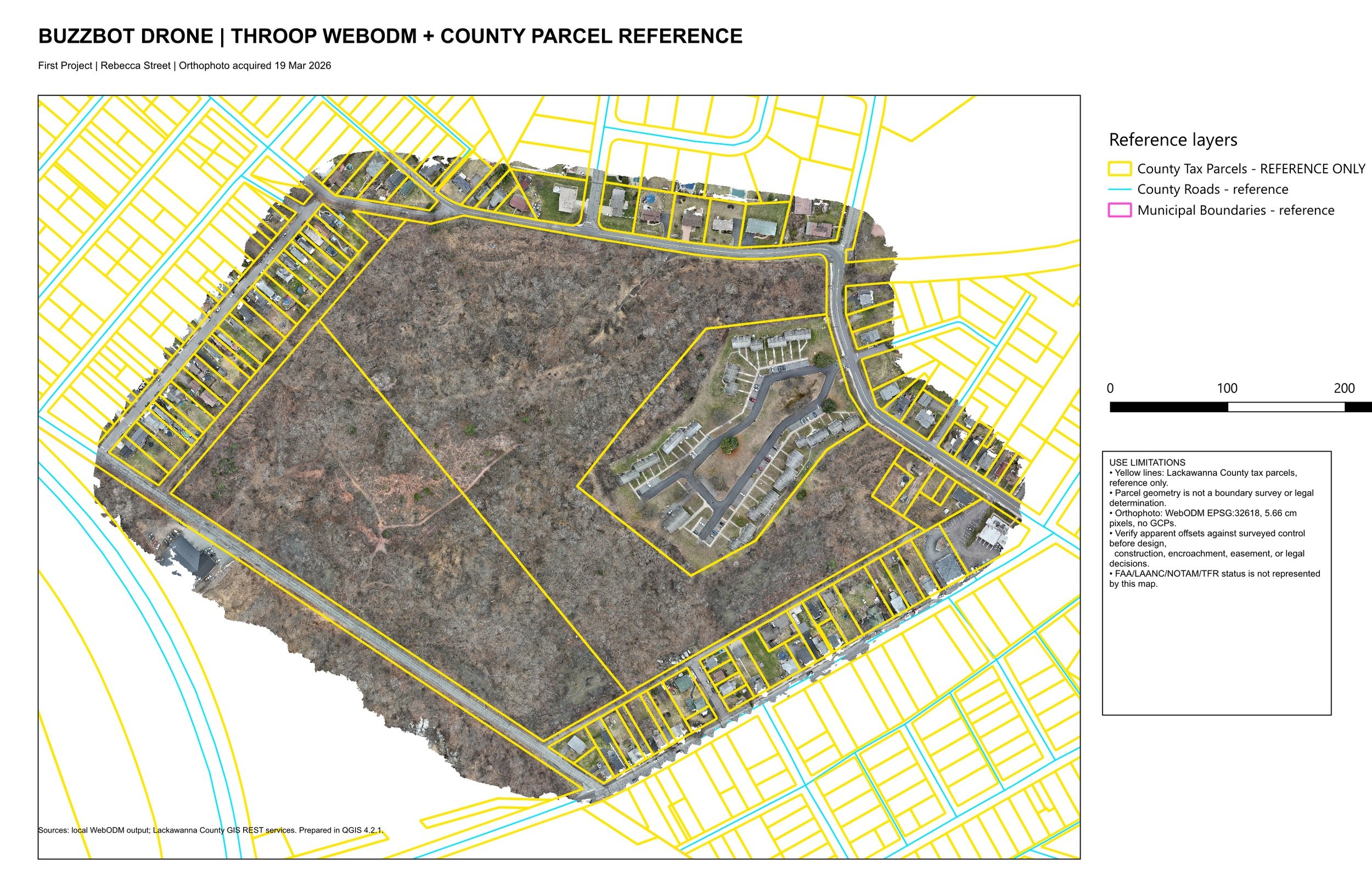
04 | GIS Parcel Reference Map Aerial imagery combined with parcel, road, and municipal reference layers. Parcel lines are reference only, not surveyed boundaries.
Useful data, clearly delivered
Site mapping. Orthomosaics bring roads, buildings, vegetation, and access into one overhead view.
Terrain and 3D. Surface and terrain models, point clouds, and custom 3D representations help you explore land, structures, and homes.
GIS workflows. We align project layers and combine aerial data with relevant parcel, road, or client reference information. Contours, slope review, and change comparisons can be scoped where the data supports them.
Progress photography. Repeat photography records changes over time.
From flight to finished files
We agree on the purpose, coverage, control, and formats; capture and process the imagery; then review the outputs and deliver maps and files suited to your workflow.
Deliverables can include GeoTIFFs, point clouds, 3D models, GIS layers, PDF maps, photographs, and video. Ground visibility and processing affect results. Parcel overlays are reference information; drone outputs do not replace a licensed survey when one is required.
Tell us about the site
Send the location, approximate area, timeline, and intended use. Include any accuracy or coordinate-system requirements. Request a project quote.